Amadora
 |
 |
There is significant evidence of Neolithic settlements in the municipality. The Necropolis of Carenque consists of three artificial caves that served as tombs from around 3000 BCE.
Originally named Porcalhota, for being a Majorat of the daughter of a man surnamed Porcalho who was called for being a female Porcalhota.
The Aqueduto das Águas Livres, which brings water from the Sintra hills to Lisbon, and stretches 30 km, was finished in the 1770s and includes the largest masonry arch ever built, located in Campolide — the local coat of arms also displays the aqueduct (like others along its way).
At the request of its population, in 1907, a decree issued during King Carlos I reign, merged the communities of Porcalhota, Amadora and Venteira into one town named Amadora.
At the present time Amadora does not have any airfield. However, in the 1920s a small airfield (the first in Portugal) was located here. The first flight from Portugal to Brazil left from Amadora. The Captain of the airplane was Adm. Gago Coutinho, a well known Portuguese celebrity.
The municipality was formed on 11 September 1979, when it ceased being a parish of the municipality of Oeiras. A few days later, on 17 September, Amadora was granted city status.
The former Sorefame railway rolling stock factory was located in Amadora, but was closed in 2004. Most of the carriages for Portuguese Railways built during the second half of the 20th century were constructed here.
Map - Amadora
Map
Country - Portugal
 |
 |
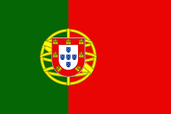
| Flag of Portugal | |
One of the oldest countries in Europe, its territory has been continuously settled, invaded and fought over since prehistoric times. The territory was first inhabited by pre-Roman and Celtic peoples who had contact with Phoenicians, ancient Greeks and Carthaginians. It was later ruled by the Romans, followed by the invasions of Germanic peoples and the Islamic invasion by the Moors, whose rule was eventually expelled during the Reconquista. Founded first as a county of the Kingdom of León in 868, gained its independence as the Kingdom of Portugal with the Treaty of Zamora in 1143.
Currency / Language
| ISO | Currency | Symbol | Significant figures |
|---|---|---|---|
| EUR | Euro | € | 2 |
| ISO | Language |
|---|---|
| PT | Portuguese language |


